But I guess being from where I come from, this kind of revelation doesn't surprise me.
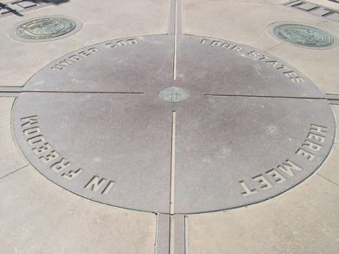
You know that fabulous marker that shows the four corners where New Mexico, Arizona, Utah and Colorado meet?
Turns out it's uh...a little off course.
In fact, potentially as much as two and a half miles off course.
The geological folks in Colorado say they think it's just fine where it is.
Other surveyors using GPS technology say nope.
"...the accurate location would be downhill to the east of U.S. 160 in Colorado and northeast of the San Juan River as it flows into New Mexico."
Uh. Ooops?
Per NewMexiKen's fabulous blog (welcome back, Ken!): " It turns out that in 1878, when they surveyed the boundaries of Utah-Colorado-New Mexico and Arizona, they adjusted the spot where the four territories met (unique in the U.S.) so that the location would be easier to get to."
Fair enough. I wonder why this is making news this week?


